|
Software
How The
System Works?
- Set
the serial port parameters in order to begin receiving the
GPS data
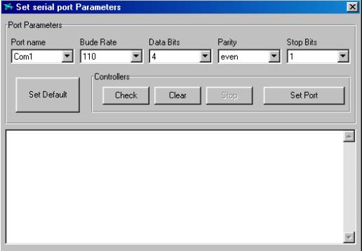
the Connect
button is enabled .
- Set
the reference frame by either setting a new one or loading
a presaved reference frame.
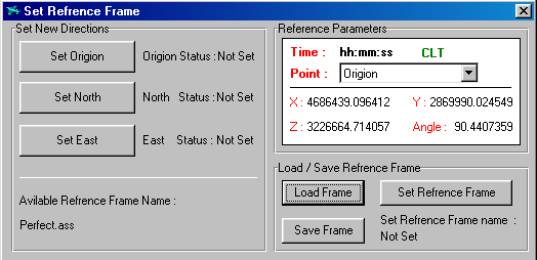
the
reference frame parameters ( origin , north ,east )
coordinates appear .
now the relative coordinates are enabled.
- Press
the connect button to begin receiving the plane location
either as :
- An
absolute location ( w.r.t the earth’s center )
- relative
location ( w.r.t the reference frame )
- the
radar system is provided with a punch of zooming tools
such as zoom in ,zoom out
and best fit.
- in
order to begin controlling the plane
- set
the plane parameters by choosing
plane control –settings
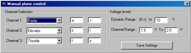
The
parameters to be set are :
-
Channel name
with the keys selected for each channel control
-
Dynamic range
of voltage output for flexible design of the interface
circuit
-
Channel dynamic
range for
accurate control.
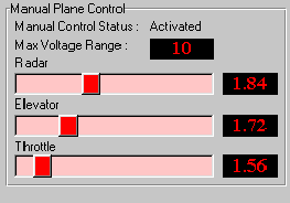
the
plane is now ready to be
controlled by the base station by just enabling
the plan control and using the selected
keystrokes or
by enabling the autopilot
|